Guide
A Hike from Lefkes village to Drios, via Langada
This is a relatively strenuous walk of just over 10 km taking around 3 – 3 ½ hours including breaks. The route includes paved roads, an ancient Byzantine trail, and small country paths. Good footwear is recommended as the ground is quite uneven in places. A great route to admire the nature of Paros and feel the real Greece.
• Duration: Around 3 ½ hours with breaks.
• Terrain: Varies between paved roads, country paths, dirt roads and ancient stone paved Byzantine trail.
• Suggested resting stops: The large red rocks with a commanding view over Lefkes soon after leaving the paved road and the small church opposite the village of Langada with views down to Aspro Horio and the sea beyond.
• Signaling: There isn't much in the way of signaling but if you pay close attention to what is written below you should have no problems.
• Accessibility: In the spring, summer and Autumn months there are frequent bus services to Lefkes and from Drios. Just be careful to check timetables before setting out
Just above Lefkes a small road branches off the main Lefkes -Parikia road. This is the best best starting point for the walk, as it cuts out climbing several steep sets of steps which link central Lefkes to the road which leads up into the hills above the ancient capital of Paros before eventually arriving at the antennae crowning Mt Agios Pantes .
Follow this road, which heads almost due south as it climbs around a series of twists and turns for around 3 ½ km. (After around 2 km, a dirt track leads straight ahead while the tarmac road bends off to the right. This is a good off road shortcut – clearly marked with red arrows, but it does mean the route gets considerably steeper).
The views all around are stunning. Lefkes lies beneath, its white cubist houses nestling between lush green terraced mountainsides which descend to the meadowlands of Piso Livadi and surrounding areas. In the distance is Naxos, clearly visible across a narrow stretch of azure blue sea.
As the road (or shortcut) continues to climb through hidden valleys, flower topped peaks and grassy plateaus the antennae grow ever closer. Shortly after the shortcut re-joins the main road there is a big water tank on the right hand side. Congratulations! You have nearly completed the uphill segment of the walk. Another 500m or so further on, around more seemingly never ending hills, the road takes a sharp turn to the right around yet another hilltop. Just before, a large blue sign (in Greek), points to a dirt track on the left heading to Lagada and Aspro Horio.
Turn left here – taking the dirt track – and finally you start to descend. There are some large rocks about 200m further on which are perfect to take a well earned break and enjoy the panoramic views from around 600m above sea level. (300m above Lefkes.)
Continue to follow the dirt road for around 700m until it turns around a very sharp hairpin bend and starts to descend steeply.
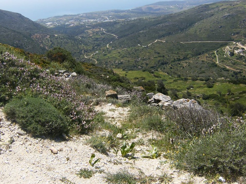
Here comes the difficult bit. About 10m after the bend, on the left hand side of the track, there is a dry stone wall, its top almost reaching the side of the road. Just before, an overgrown path leads off, again to the left, almost following the route of the wall. (See photograph). It isn't the easiest to find but at the time of writing an abandoned fridge nest to the wall helped to signpost it. From the road you should be able to see the path as it snakes down the hillside, although if you can't find it, it's still very enjoyable to walk along the dirt road as it twists and turns clinging to the opposite side of the valley from our suggested route.

The beginning of the footpath to Lagada

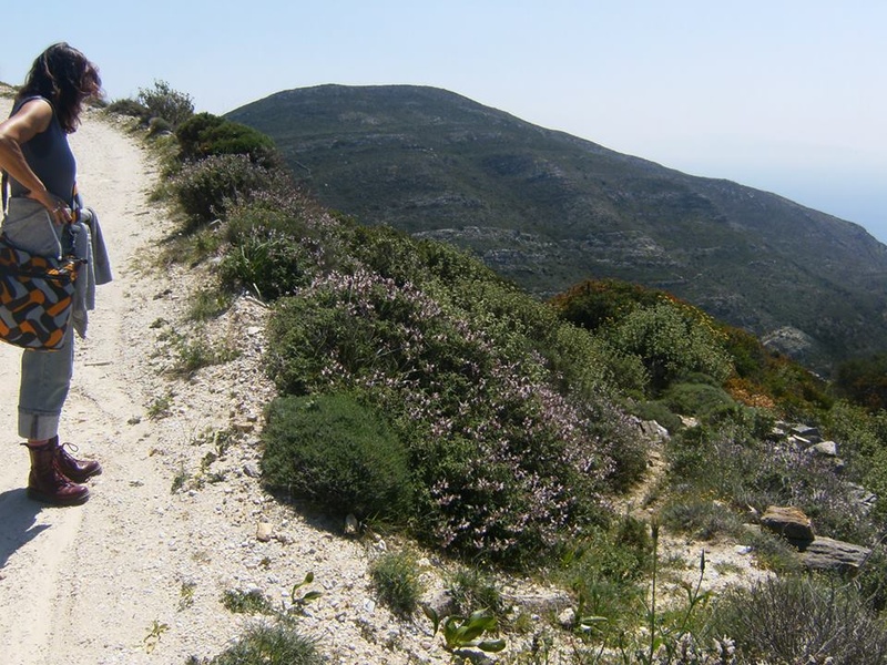
The footpath to Lagada
Having successfully found the path, follow it down though the (outside of summer), luxuriant countryside, past bushes of wild Thyme and Sage. Whilst not exactly easy to find the path's start, it is very easy to follow and after a few metres widens considerably, although the ground is very uneven so take care where and how you place your feet.
A few hundred metres later a small church, literally in the middle of nowhere comes into view.
Head towards it, crossing a dirt track on the way.
It's a perfect place to stop and take a longer break. The views across the valley and down to the village of Aspro Horio are breathtaking, and well worth that long uphill climb you just completed.
To continue, go back to the dirt track and turn left. Head downhill along this track and just around the corner you will find the beginning of one of the most well preserved and relatively unknown stretches of Byzantine trail which in years gone by was part of a network that criss-crossed the island linking inland villages with the coastal regions below.
The path from here consists of a metre or so wide, cobbled winding walkway which twists and turns as it passes steadily downhill to a waterfall and a dry stone bridge, still in perfect working order centuries after it was built.
Cross the bridge and follow the dirt path until it crosses and re-crosses the small stream.
At this point you have two options: Turn right and re-join the original dirt road you left high in the mountains and head towards the village of Aspro Horio with it's magnificent church (but very little else), or follow the clearly visible path on the left hand side of the valley. This is the route we took, walking between dry stone walls before arriving at another hair pin bend. Don't head uphill, instead go straight ahead. At this point the path narrows dramatically and the going gets very uneven and overgrown almost like where you first went off road but after a few hundred metres or so it again widens into a clear path.
From here the route follows the edge of a steep cliff which hangs over the edge of the stream running 20 or so metres below. Here onwards the path becomes clearly visible, there were even cycle tyre tracks the day we walked it.
There are a few obstacles to overcome such as a section of fallen wall and some very spiky bushes but overall the going is very easy.
Eventually the path emerges into more open countryside where a very small , and very vocal dog was guarding a group of sheep that looked up nonchalantly as we passed, little knowing their fate…..Easter was only a few days away.
A few hundred metres later the path emerges onto a dirt road under the shade of an old olive tree before passing a small farm with a couple of very friendly goats and a field full of ancient, rusty, and strangely scenic farm machinery.
After the farm, it's a short walk down to the island's ring road. Turn left and a blue sign announces you are entering the village of Drios. Another 600m or so later and you will arrive at the main square of Drios, the bus stop and the (hopefully open) minimarket.
There are numerous restaurants, bars and tavernas in Drios if you are in need of refreshment after the walk.
Andy Kirk


